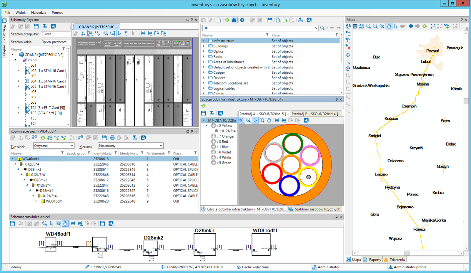
SunVizion Physical Network Inventory is utilized to gather, process, and furnish information about physical network resources. By seamlessly integrating both inside and outside plant data, the system maintains records about infrastructure elements such as buildings, rooms, room equipment, cable routes, duct segments, cable chambers, manholes, cabinets, utility poles, and cables, Additionally, it records details about their physical utilization, including card distribution within shelves, cable occupancy in ducts, and the allocation of physical ports on devices used by connected cables.
Physical Network Inventory - Data Availability
- Immediate access to all information about network resources and their physical attributes
- Presentation and localization of network resources on digital maps with scale-dependent visibility
- Powerful GIS environment from Esri
- Smart mobile application designed for field workers

Objects Control
- Cross-sectional approach
- Advanced compatibility control features designed to accommodate various device types, technologies, and available bandwidth
- Presentation of auxiliary documents linked to an object (with the possibility of integration with an external repository)
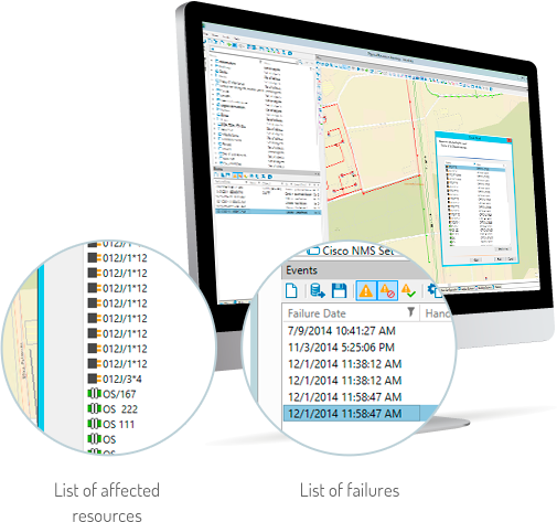 Network Failure Analysis

- Identifies failure consequences and analyzes their impact on the network and services provided to users
- Manages the process of planned disconnections and analyzes their results
- Controls SLA arrangements
- Reports data on current failures and historical failure percentage ratios for network elements
- Supports all types of telecommunication networks and network technologies
- Maintains a logical resource inventory, recording the resource’s functionality, bandwidth, and its relationships with other physical and logical resources
 Advanced Map Interface
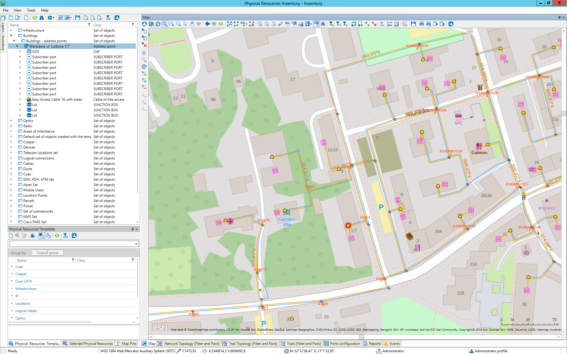
- Possibility of visualization on Google Maps and Google Earth – an attractive option for users who do not require the advanced map interface
- Resources displayed on the Google Earth map can be accessed through an external service that provides data in KML format or can be exported to the map.
